A Bundle is already in your cart
You can only have one active bundle against your account at one time.
If you wish to purchase a different bundle please remove the current bundle from your cart.
You have unused credits
You still have credits against a bundle for a different licence. Once all of your credits have been used you can purchase a newly licenced bundle.
If you wish to purchase a different bundle please use your existing credits or contact our support team.
Loading video...
@jozefstano
02:21

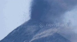
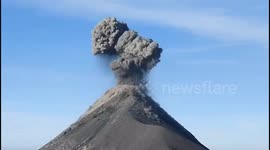
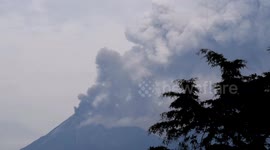
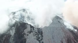
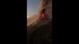
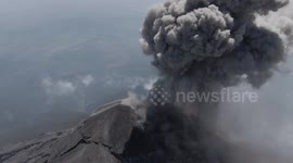
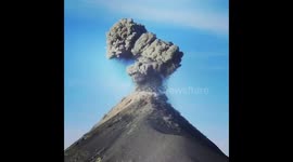
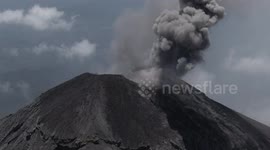
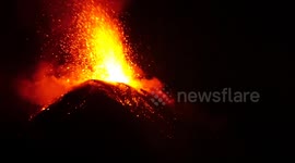
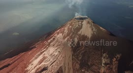
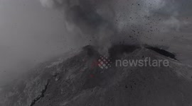
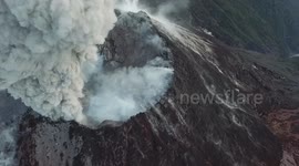
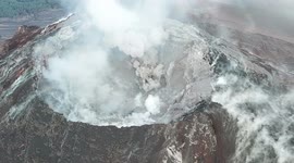
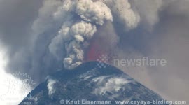
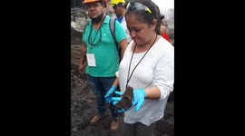
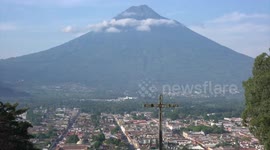
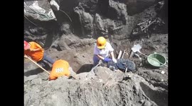
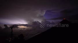
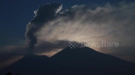
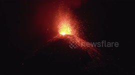
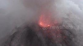
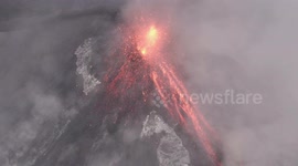
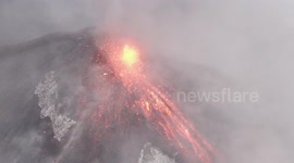
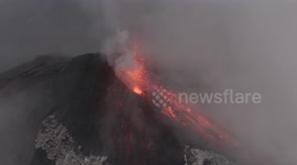
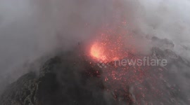
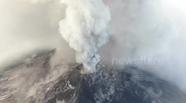
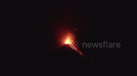
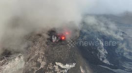
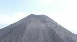
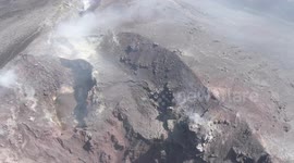
One week on, aerials reveal desolate landscape from Guatemala eruption
Aerial footage of Guatemala's Fuego volcano a week after it erupted shows its markedly changed landscape.
Jozef Stano, a videographer from Slovakia, captured the footage by drone flown at a height of 4,800 metres on June 10.
It shows how Fuego's landscape has been affected by the eruption, now shorn of vegetation reportedly caused by shock waves as well as hot rock and gasses emitted by the eruption.
Stano says he operated the drone from nearby Acatenango volcano.
“I was in Guatemala while big eruption occurred and I wanted to see how El Fuego looks like after that. I have been there a few times, it fascinates me how the volcano is changing all the time. I had to go there even if nobody went there because of curiosity.
“I’m in Guatemala for the second time and as I like nature, so I go to the volcano Acatenango all the time. It is really nice to get so close to the active volcano and see all those colours.”
Categories
From the blog
Stories not Stock: 3 Reasons Why You Should Use UGC Instead of Stock Video
Video content is an essential part of a brand’s marketing strategy, and while stock footage has been a reliable go-to in the past, forward-thinking companies are looking to user-generated content for their video needs.
View post