A Bundle is already in your cart
You can only have one active bundle against your account at one time.
If you wish to purchase a different bundle please remove the current bundle from your cart.
You have unused credits
You still have credits against a bundle for a different licence. Once all of your credits have been used you can purchase a newly licenced bundle.
If you wish to purchase a different bundle please use your existing credits or contact our support team.
00:09

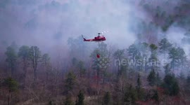
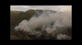
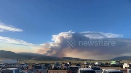
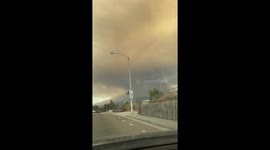
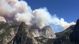
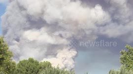
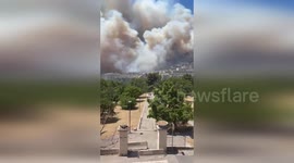
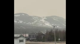
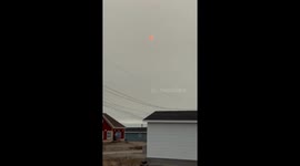
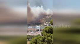
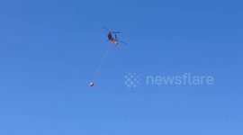
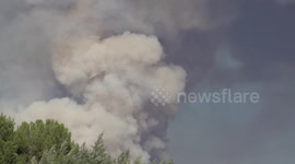
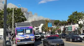
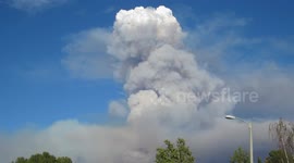
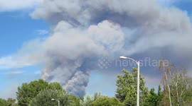
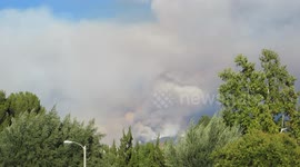
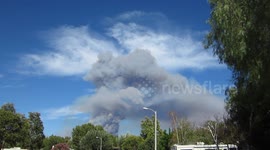
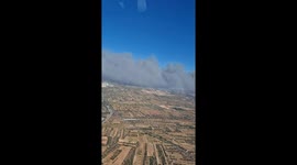
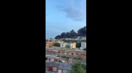
US: AI Drones Track Wildfire Smoke Hidden In The Air

Minneapolis, United States - September 02, 2025 MINNEAPOLIS / ST. PAUL — Researchers at the University of Minnesota Twin Cities have built aerial robots fitted with artificial intelligence to detect, follow and analyze wildfire smoke plumes. The study, published in Science of the Total Environment, demonstrates how AI-equipped drones can observe smoke behavior and feed higher-resolution data into dispersion models. A 2024 Associated Press report noted 43 wildfires resulted from 50,000 prescribed burns between 2012 and 2021, underscoring the need for improved smoke-management tools. Past simulation and field tools struggled to capture particle behavior accurately. The new research addresses those limitations by using coordinated, AI-directed aerial robots to collect detailed observations of plumes in real time. “A key step is understanding the composition of smoke particles and how they disperse,” said Jiarong Hong, professor of mechanical engineering and senior author. The team found that smaller particles travel farther and remain aloft longer, affecting regions distant from the fire. Using a swarm of AI-guided aerial robots, the researchers captured multiple angles to build 3D reconstructions of plumes and map flow patterns. Unlike conventional drones, these robots can identify smoke and navigate into plumes to gather data. “This approach allows for high-resolution data collection across large areas—at a lower cost than satellite-based tools,” said Nikil Nrishnakumar, a graduate research assistant and first author. The technique could improve simulations and inform hazard response. The method may also apply to sandstorms, volcanic eruptions and other airborne hazards. The team plans to refine plume tracking and particle characterization with Digital Inline Holography and deploy longer-endurance fixed-wing VTOL drones for extended surveillance. Authors include Shashank Sharma and Srijan Kumar Pal. The work was supported by the National Science Foundation Major Research Instrumentation program and conducted with St. Anthony Falls Laboratory.
Categories
From the blog
Stories not Stock: 3 Reasons Why You Should Use UGC Instead of Stock Video
Video content is an essential part of a brand’s marketing strategy, and while stock footage has been a reliable go-to in the past, forward-thinking companies are looking to user-generated content for their video needs.
View post