A Bundle is already in your cart
You can only have one active bundle against your account at one time.
If you wish to purchase a different bundle please remove the current bundle from your cart.
You have unused credits
You still have credits against a bundle for a different licence. Once all of your credits have been used you can purchase a newly licenced bundle.
If you wish to purchase a different bundle please use your existing credits or contact our support team.
01:18

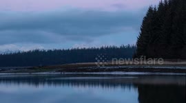
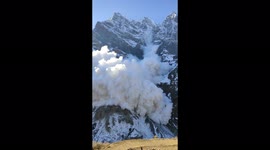
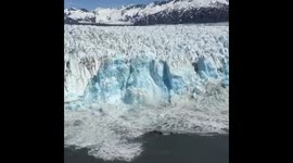
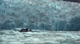
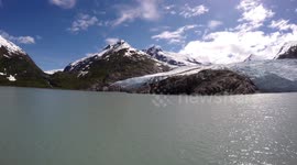
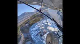
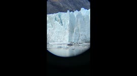
US: Massive Landslide In Southeast Alaska Triggers Tsunami And Shakes Glacier

United States - August 16, 2025 Southeast Alaska, USA – A colossal landslide on Sunday unleashed more than 100 million cubic meters of debris into Tracy Arm fjord and onto South Sawyer Glacier, creating a powerful tsunami in one of the largest slides recorded in at least a decade, according to the Alaska Earthquake Center. The center, based at the University of Alaska Fairbanks Geophysical Institute, rapidly pinpointed and analyzed the event using a system it has been developing to detect and characterize landslides in real time. “This is larger than anything in the past decade in Alaska,” said Michael West, director of the Alaska Earthquake Center. “It’s going to get a lot of attention from scientists.” The landslide struck at about 5:30 a.m. at the head of Tracy Arm, a fjord located 50 miles southeast of Juneau. Preliminary calculations suggest the debris volume equaled the contents of 40,000 Olympic-sized swimming pools. Research seismologist Ezgi Karasözen explained, “We were able to produce a rapid location and volume estimate using seismic data as soon as we learned about the event.” Seismic data manager Heather McFarlin said the energy released was roughly the same as a magnitude 5 earthquake. The collapse sent waves surging nearly 100 feet up Sawyer Island, four miles from the site. At Harbor Island, 36 miles away, witnesses reported 20-foot waves. Cruise ships and sightseeing vessels often travel through the fjord, raising concern about potential dangers to thousands of passengers. Karasözen noted that seismic stations had recorded more than a day of precursor signals. “This may be the best-documented example of such precursors,” she said, adding that improving early detection could be a major focus going forward. West called the possibility of recognizing warning signals in advance the “Holy Grail of hazard monitoring.” The center confirmed its initial estimate was within seven kilometers of the true location, later verified by Coast Guard reconnaissance. While precise volume measurements may take months, West emphasized, “We now have the ability to quickly analyze and report the size, location and style of landslides. That opens the door for building proper warning systems.”
Categories
From the blog
Stories not Stock: 3 Reasons Why You Should Use UGC Instead of Stock Video
Video content is an essential part of a brand’s marketing strategy, and while stock footage has been a reliable go-to in the past, forward-thinking companies are looking to user-generated content for their video needs.
View post