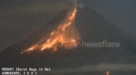
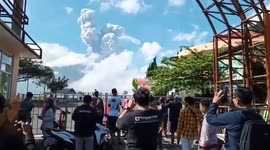
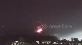
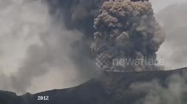
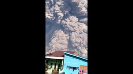
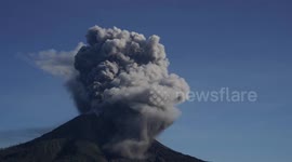
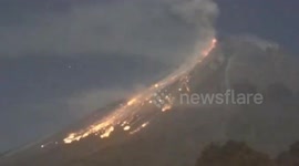
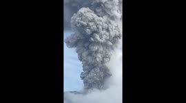
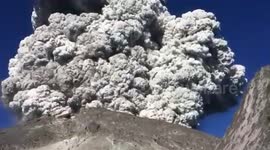
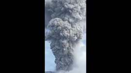
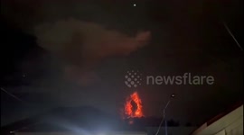
Enormous hot clouds formed after the eruption of Mount Merapi, Indonesia, on March 11.
The volcano, located in Indonesia’s Yogyakarta special region, spewed smoke up to seven kilometres. It was already on the country's second-highest alert level.
In his official statement, the Head of the Geological Disaster Technology Research and Development Center (BPPTKG), Agus Budi Santoso, said:
"At this time, the eruption is still ongoing. People are advised to stay away from the danger zone".
The Research and Development Center for Geological Disaster Technology (BPPTKG) asked the public to stay away from the danger zone within a 7-kilometer radius of the peak of the stratovolcano.
Tourism and mining activities have been halted.
JAKARTA - Mount Merapi again spewed hot clouds of avalanches (APG), Saturday (11/3) at 12.12 WIB towards the Bebeng/Krasak River. The Research and Development Center for Geological Disaster Technology (BPPTKG) for the Special Region of Yogyakarta said the eruption was still going on until 12.31.
"The distance is 7 kilometers from the peak of Mount Merapi in the Bebeng and Krasak Kali flows. At the time of this eruption it was still ongoing," said the BPPTKG in a written message.
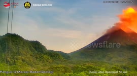
In the visual recording of the BPPTKG, the mountain is clearly observed up to 0-II fog. Weak pressure crater smoke is observed to be white with medium intensity and high 50-100 meters above the top of the crater.
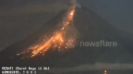
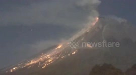
In addition, it was also observed 1 time lava splash with a sliding distance of 1500 meters to the southwest 2 times the sound of falling with moderate intensity from Pos Babadan.
BPPTKG also observed the status of the seismicity including the number of observed fallouts of 9, an amplitude of 4-11 mm and a duration of 43.9-96.6 seconds. Next is hybrid/many phase 1, amplitude 5 mm, S-P 0.4 seconds and duration 7.4 seconds. Next, there are 19 deep volcanic records, amplitude 9-12 mm, S-P 0.5-1 second and duration 9.3-11.2 seconds.
Furthermore, BPPTKG stated that the current hazard potential is in the form of lava avalanches and hot clouds in the south-west southwest sector including the Boyong River for a maximum of 5 km, the Bedog River, Krasak, Bebeng for a maximum of 7 km.
In the southeastern sector it includes the Woro River for a maximum of 3 km and the Gendol River for 5 km. While the ejection of volcanic material in the event of an explosive eruption can reach a radius of 3 km from the summit.
In order to anticipate the potential danger of the eruption of Mount Merapi, the community is advised not to carry out any activities in the potential hazard area.
The public is asked to always anticipate disturbances caused by volcanic ash from the eruption of Mount Merapi and be aware of the danger of lava, especially when it rains around Mount Merapi.
BBPTKG also stated that if there is a significant change in activity, then the activity status of Mount Merapi will be reviewed immediately. Currently, the status of Mount Merapi is still at level III or 'standby' since November 2020.
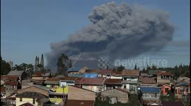
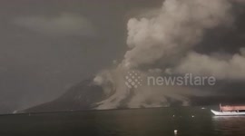
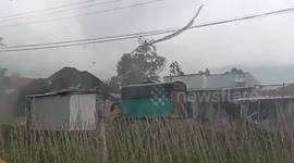
*Volcanic Ash Heads Northwest*
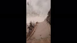
Meanwhile, based on reports from the Mount Merapi Observation Post in Babadan, the hot cloud avalanches also triggered volcanic ash that headed northwest-north. Babadan Pos officer, Yulianto said in a telephone connection that the Babadan Post had started testing volcanic ash which was quite thick.
"If the APG is heading southwest, towards Kali Bebeng and Krasak. But if the volcanic ash is heading northwest-north. Because of the wind factor, yes," explained Yulianto.
"If Pos Babadan is currently practicing APG. It's quite thick," Yulianto added.
Furthermore, Yulianto has also received reports from several locations that also photographed volcanic ash. The details are Mangunsuko Village, Shaman Village, Patent Village and Sengi Village in Shaman District, Magelang Regency. Furthermore Wonolelo Village and Krogowanan Village in Magelang Regency. Furthermore, Klakah Village and Tlogolele Village are in Selo District, Boyolali Regency.
Regarding evacuation, Yulianto has not received reports of residents fleeing in the area affected by the volcanic ash. Yulianto explained that he was asked by the BPPTKG to provide recommendations to local residents to evacuate if the area covered by hot clouds of avalanches and volcanic ash develops in several incidents and is farther than 7 kilometers.
"This has only been observed once. There have been 5-6 avalanches. If the coverage continues to grow and the distance is further than 7 kilometers, there will most likely be recommendations for residents to evacuate," explained Yulianto.
The results of field monitoring from the Regional Disaster Management Agency (BPBD) of Sleman Regency, Magelang Regency, Boyolali Regency and Klaten Regency, there have been no reports of significant impacts or casualties. The situation and conditions are still under control. Report results and follow-up monitoring will be updated regularly.
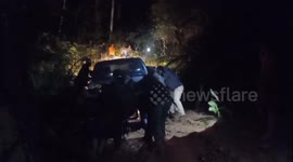
The video was recorded by Ferry Dwi, 29, who was at the location of the volcanic eruption. I requested a video to be uploaded to Newsflre